頭城鎮有24個里行政區,其中人口多半集中在鎮中心。因而,雖然老街附近雖然面積小,但卻切分為四個里,是頭城最繁榮的地方。若想要移居至頭城,可以參考城中四里或者新建里、拔雅里、大坑里等。而靠南部各里多農田,居民也多為當地居民,公共交通並不方便,但依山傍水,風景秀麗。
以下是頭城各里的介紹。
Toucheng Township has 24 districts. Touwei Street, located in the town center, is the most populated and prosperous area, divided into four districts.For those new to the area and looking for places to live, the central districts, as well as Xinjian, Bayar, and Dakeng, are great options.
The southern districts are more rural, offering beautiful mountain and river scenery but limited public transportation.Here is an introductions for each district .
城東里
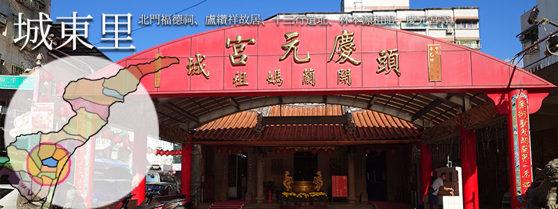
日治時期,1900年拔雅林庄分為武營前、武營後、北門坑、拔雅林、西寮庄及頭圍街,次年又將西寮庄部份及頭圍街則獨立為頭圍街。光復後因此區人口眾多,乃將頭圍街依位置分為城東、城南、城西、城北四里,城東里顧名思義因位居頭圍街之東部。內城四里的面積十分迷你,城東里面積只有0.052平方公里,但包括大家而熟能詳的北門福德祠、盧纘祥故居、十三行遺址、林本源租館、慶元宮等名勝古蹟外,頭城區漁會、國光號車站、三老房、金魚厝邊等機構均屬於城東里。→更多城東里生活資訊
Chengdong Village
During the Japanese colonial period in 1900, Bayalin Village was divided into Wuying Front, Wuying Back, Beimenkeng, Bayalin, Xiliao Village, and Touwei Street. The following year, parts of Xiliao Village and Touwei Street were separated into the independent Touwei Street.
After Taiwan’s retrocession, due to the dense population in this area, Touwei Street was divided into four districts based on location: Chengdong (East), Chengnan (South), Chengxi (West), and Chengbei (North). As its name suggests, Chengdong Village is situated in the eastern part of Touwei Street.
Although Chengdong Village is very small, covering only 0.052 square kilometers, it is home to several well-known landmarks, including Beimeng Fude Temple, the ancestral residence of Lu Tzuan-hsiang, the Shisanhang Archaeological Site, Lin Benyuan Rent Hall, and Qingyuan Temple. Important institutions such as the Toucheng Fishermen’s Association, Kuokuang Bus Station, Sanlao House, and Goldfish Neighbors are also located here.→more
城西里
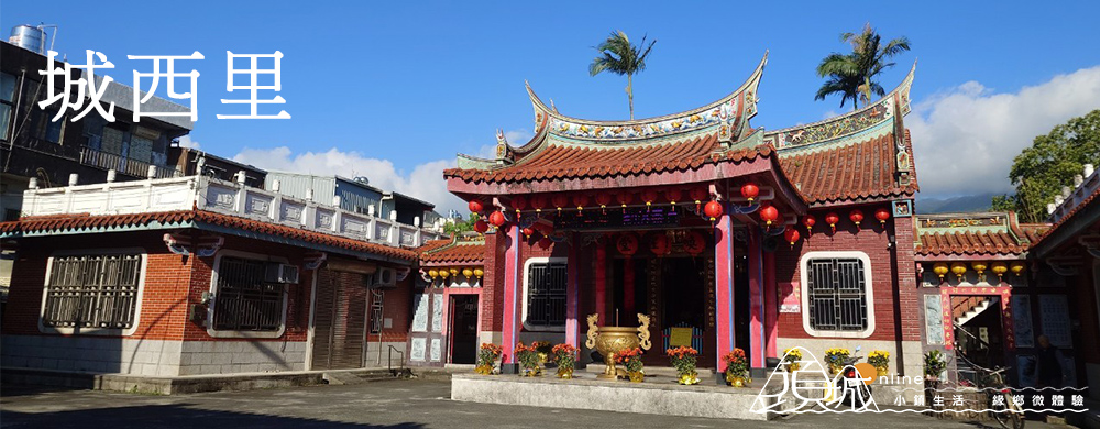
1940年行政區調整時,將頭圍街依位置分為城東、城南、城西、城北四里,本里因位居頭圍街之西部,因此稱之為城西里。儒教重要的信仰中心喚醒堂、頭城文創園區等歷史建築均位於本里,此外,本區還有許多知名飲食店家,除了吸引觀光客品嘗外,也是當地居民日常外食消費之處。→更多城西里生活資訊
Chengxi Village
Chengxi Village was established in 1940 during an administrative reorganization. It was named for its location in the western part of Touwei Street, which was divided into Chengdong, Chengnan, Chengxi, and Chengbei districts.
The area is home to notable cultural landmarks such as the Confucian Waking Hall and the Tou Cheng Cultural and Creative Park.
Chengxi is also known for its renowned dining establishments, which attract both tourists and locals for daily meals and culinary experiences.→more
城南里
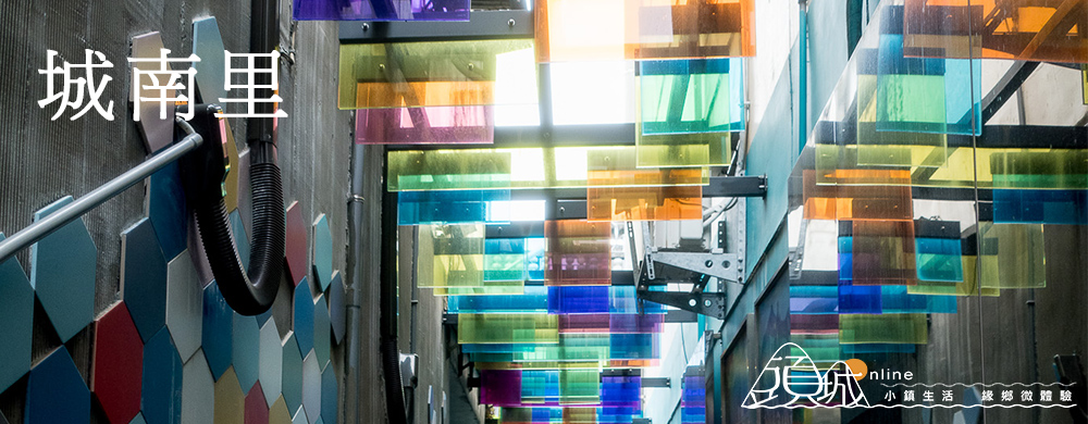
1940年行政區調整時,將頭圍街依位置分為城東、城南、城西、城北四里,本里因位居頭圍街之本里因位居頭圍街之南部,故名城南里。
本里位於頭城鎮市區中心,交通四通八達,南門土地公廟與和平老街均位於本區。→更多城南里生活資訊
Chengnan Village
Chengnan Village was established in 1940 during an administrative reorganization. It was named for its location in the southern part of Touwei Street, which was divided into Chengdong, Chengnan, Chengxi, and Chengbei districts.
Located in the heart of Tou Cheng Town, Chengnan is highly accessible with excellent transportation links. Notable landmarks in the area include the South Gate Earth God Temple and the historic Heping Old Street.→more
城北里
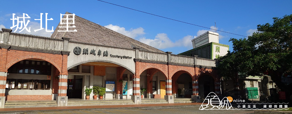
1940年行政區調整時,將頭圍街依位置分為城東、城南、城西、城北四里,本里因位居頭圍街之本里因位居頭圍街之南部,故名城北里。本里為頭城政治、經濟、文化中心,鎮公所、圖書館、火車站、公有市場等重要設施和單位均設於此。→更多城北里生活資訊
Chengbei Village
In 1940, during an administrative reorganization, Touwei Street was divided into four villages based on location: Chengdong, Chengnan, Chengxi, and Chengbei. Chengbei Village, located in the southern part of Touwei Street, was named accordingly.
This village serves as the political, economic, and cultural center of Toucheng. Key facilities and institutions, such as the town hall, library, train station, and public market, are all located here.→more
石城里
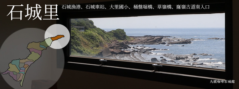
石城里位於頭城鎮最北部,面積3.54平方公里,境內多屬山區,臨海有石城漁港,居民多靠海維生。西北方與新北市貢寮鄉相接,自古即為進出蘭陽平原之通道,現今為北迴線鐵路及濱海公路進入宜蘭第一站。石城漁港、石城車站、大里國小、桶盤堀橋、草嶺橋、嶐嶺古道南入口的所在區域均屬石城里。→更多石城里生活資訊
Shicheng Village
Shicheng Village is located in the northernmost part of Toucheng Township, covering an area of 3.54 square kilometers. The village is largely mountainous, with Shicheng Fishing Port along its coastline, where most residents make their living from the sea.
To the northwest, it borders Gongliao District in New Taipei City and has historically been a key passage to the Lanyang Plain. Today, it serves as the first stop in Yilan for the North-Link Railway and Coastal Highway.
Landmarks in the village include Shicheng Fishing Port, Shicheng Railway Station, Dali Elementary School, Tongpanhu Bridge, Caoling Bridge, and the southern entrance of the Longling Historic Trail.→more
大里里
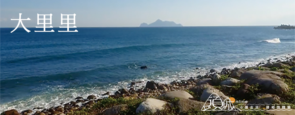
舊名大里簡,居民多以漁業為生,在前人的詩詞中曾提到「大里漁燈」勝元宵,可見舊時捕魚活動的盛況。現今雖然漁業沒落,且位置遠離城鎮中心,但由於草嶺古道帶來許多遊客,尤其是在每年冬季的芒花季時,更為熱鬧。草嶺古道的登山口旁是大里天公廟與東北角遊客中心。此外,往海邊走,不但可以逛大里老街,還可前往海邊祕境——大里海堤,面對海水拍岸,可以忘卻許多煩憂。
大眾交通方式:搭乘火車至大里站下車,步行即可遊覽各景點。→更多大里里生活資訊
Dali Village
Formerly known as Dali Jian, this village was once a thriving fishing community, celebrated in old poems for its “Dali fishing lights.” Although fishing has declined and the village is far from the town center, it attracts many tourists due to the Caoling Historic Trail, especially during the autumn silver grass season. Near the trailhead are Dali Tiangong Temple and the Northeast Coast Visitor Center.
Visitors can also explore Dali Old Street and the secluded Dali Seawall, a peaceful spot to enjoy the ocean waves.
Public Transportation:Take the train to Dali Station; all attractions are within walking distance.→more
龜山里
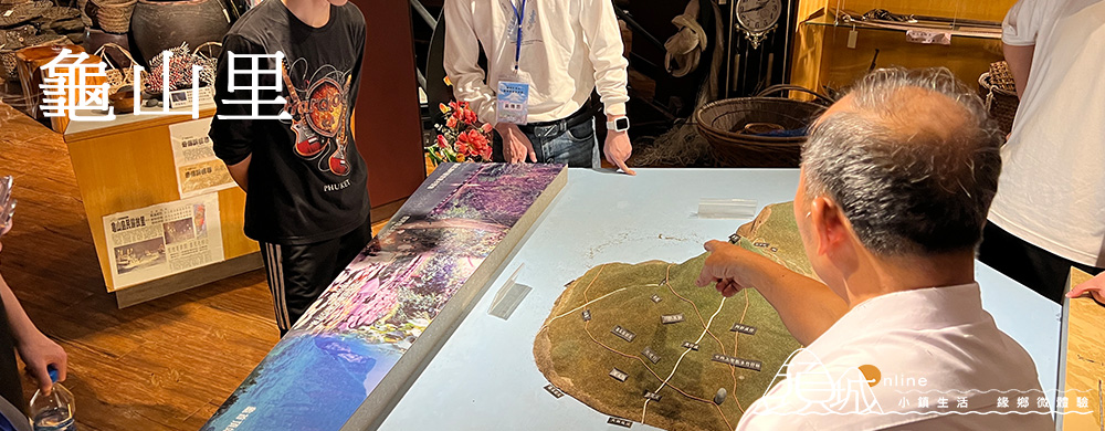
龜山島是一座活火山島嶼,因其外型像烏龜而得名。龜山里原本位於龜山島上,但1974年間,政府將島上居民遷移到大溪的「仁澤新村」,併入大溪里。後經居民陳情,2000年將仁澤新村改稱為龜山島社區,並恢復為龜山里。
大眾交通方式:搭乘火車至龜山車站下車後,步行可達。→更多龜山里生活資訊
Guishan Village
Guishan Island is an active volcanic island, named for its turtle-like shape. Originally, Guishan Village was located on Guishan Island itself.
However, in 1974, the government relocated the island’s residents to a new settlement called “Renze Village” in Daxi, which was incorporated into Daxi Village. After a petition from the residents, in 2000, the name “Guishan Island Community” was restored, and the area was once again recognized as Guishan Village.
Public Transportation:Take the train to Guishan Station, from which you can reach the village by walking.→more
大溪里
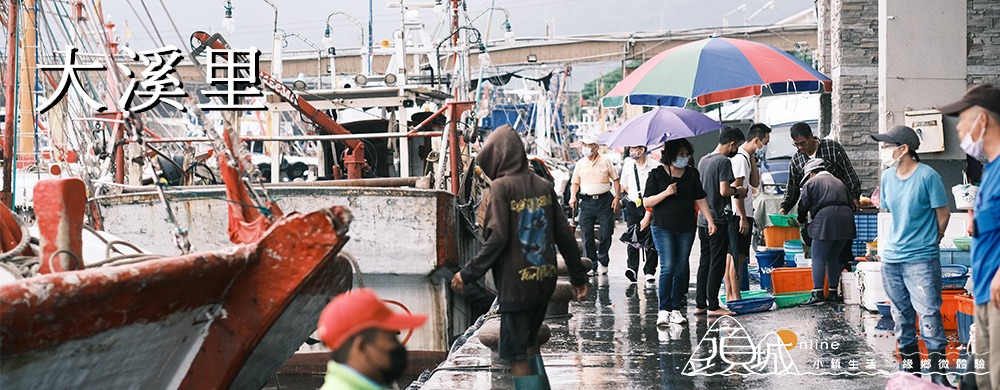
大溪因大溪川而得名,此溪為漢人入蘭之後所經過的第一條長河,故名大溪。大溪川流域是目前頭城北側最主要的自來水水源地,最後於大溪漁港入海。
大溪漁港在1975年擴建後,成為頭城鎮最主要的漁港,並有漁市場,每日下午3點後,漁船陸續進港,市場交易熱絡,成為特別的假日觀光景點,此外還有桃源谷、石盤寮瀑布、鷹石尖等景點,吸引許多喜好登山休閒民眾前來。
大眾交通方式:搭乘火車至大溪站,步行即可遊覽。→更多大溪里生活資訊
Daxi Village
Named after the Daxi River, the first major river encountered by early Han settlers in the area, Daxi Village serves as the primary water source for northern Toucheng Township. The river flows into the sea at Daxi Fishing Harbor.
Expanded in 1975, Daxi Fishing Harbor became the main port of Toucheng, featuring a fish market where boats arrive daily around 3 p.m., creating a lively scene. Popular nearby spots include Taoyuan Valley, Shipanliao Waterfall, and Yingshijian, drawing hikers and outdoor enthusiasts.
Public Transportation:Take the train to Daxi Station; attractions are within walking distance.→more
合興里
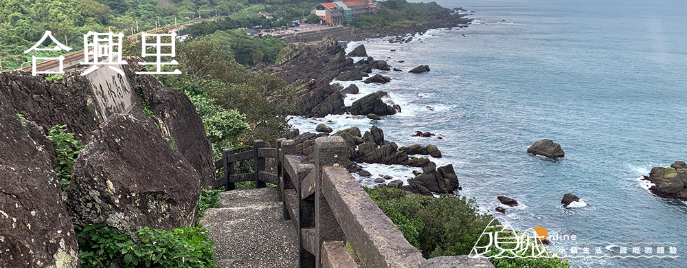
合興里是從大溪里獨立出來的,大溪國小因此位於此里,而合興社區為靠山面海的漁村,雖然人口少,但居民情感緊密,曾獲選為全國十大模範社區。里內的忠孝新村是1955年間大陳義胞撤退來臺後,政府為安頓他們所建置,村內的「天后宮」,供奉自大陳攜來之媽祖、呂洞賓與三官大帝神像。除了人文風光外,海邊還有蜜月灣、北關風景區等景觀可以遊憩。
大眾交通方式:搭乘火車至大溪站,步行5分鐘可達合興社區。→更多合興里生活資訊
Hexing Village
Hexing Village was separated from Daxi Village, so Daxi Elementary School is now located here. This small fishing community, set between mountains and the sea, is known for its strong sense of community and was once recognized as a top model community in Taiwan.
Within Hexing, Zhongxiao New Village was established in 1955 to resettle displaced residents from Dachen Island. The village’s Tianhou Temple houses statues of Mazu and other deities brought from Dachen. Nearby, visitors can enjoy Honeymoon Bay and Beiguan Scenic Area.
Public Transportation:Take the train to Daxi Station, then walk about 5 minutes to reach Hexing Community.→more
更新里
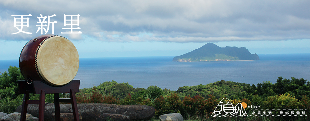
原名梗枋里,由於在台語音譯有「山硬硬的崩落下來」的意思,在1969年芙勞西颱風來襲時,山坡地「硬崩」後,當地居民的要求更名為「更新里」,里內重要公共設施有梗枋漁港、漁產拍賣場、梗枋國小等。除了漁港是遊客喜歡探訪之地外,頭城及北關二座休閒農場也是需要早早預訂的休閒渡假桃花源。
大眾交通方式:搭乘火車至龜山站,對面即是梗枋漁港。→更多更新里生活資訊
Gengxin Village
Originally named Gengfang, the village’s name was changed to “Gengxin” (meaning “renewal”) after a landslide during Typhoon Flossie in 1969.
Key facilities include Gengfang Fishing Harbor, a seafood auction market, and Gengfang Elementary School. The fishing harbor is a popular visitor spot, and nearby Toucheng and Beiguan farms are sought-after retreats that require early reservations.
Public Transportation:Take the train to Guishan Station; Gengfang Fishing Harbor is directly across from the station.→more
外澳里
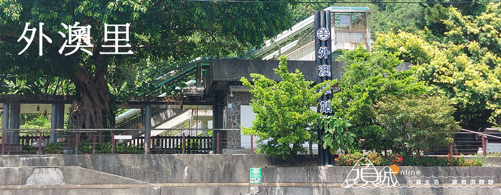
外澳,因位於烏石港之外的灣澳而得名,擁有平坦的沙灘,從外澳火車站出來,過馬路即是海堤步道。往北是雙獅海灘,往南則是外澳沙灘,每逢夏季,吸引許多親子遊客前來戲水,還有飛行傘、騎馬等休閒活動。外澳海邊有座鮮黃色建築是外澳服務區,除設有付費的淋浴區提供遊客使用外,還有9號咖啡館更提供餐飲小點和借問站等服務。
大眾交通方式:搭乘火車至外澳站,過馬路即可抵達海邊。→更多外澳里生活資訊
Wai’ao Village
Wai’ao got its name from the bay outside Wushi Harbor. It features flat, sandy beaches, and from Wai’ao Train Station, you can cross the road to reach the seawall trail. To the north lies Shuangshi Beach, and to the south is Wai’ao Beach. Every summer, many families visit for water activities, as well as leisure options like paragliding and horseback riding.
Near the Wai’ao coastline, a bright yellow building serves as the Wai’ao Visitor Center. It offers paid shower facilities for visitors, as well as the No. 9 Café, which provides light snacks, beverages, and visitor information services.
Public transportation: Take the train to Wai’ao Station, and cross the road to reach the beach.→more
港口里
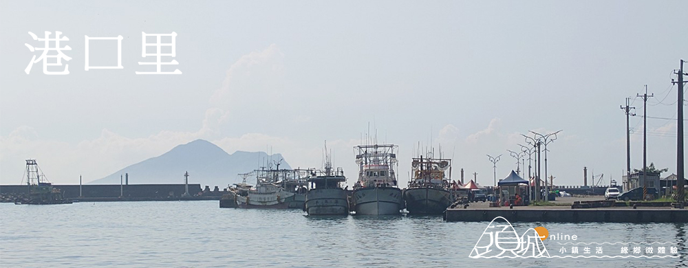
港口是指位於烏石港之口,往北緊鄰外澳里,雖是一片沙灘連綿景致,但以港澳溪為界,分成兩里,里民多從事漁業,以捕撈魩仔魚為主;也兼營農業,主要農產品有稻米、番石榴、蓮霧等,「鹹水月芭樂」尤富盛名。著名的衝浪街一條街、烏石港、蘭陽博物館等居位於本里。
大眾交通方式:搭乘火車至外澳站,步行往南即可抵達。→更多港口里生活資訊
Gangkou Village
Gangkou refers to the area at the mouth of Wushi Harbor, located just south of Wai’ao. While the region features a continuous stretch of sandy beach, it is divided into two villages by the Gang’ao River. Most residents engage in fishing, with whitebait being the primary catch. They also practice agriculture, producing crops such as rice, guava, and wax apples, with the locally renowned “Salty Water Guava” being particularly famous.
Notable landmarks in the village include the Surf Street, Wushi Harbor, and the Lanyang Museum.
Public transportation: Take the train to Wai’ao Station and walk south to reach Gangkou.→more
福成里
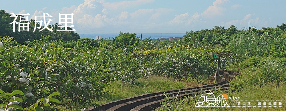
福城里西邊與新北市接壤,境內多山,山中多名勝寺廟,寺廟數居全鎮之冠。在頭城藍染產業盛行時,此地為藍染原料的植物「大青」的產地,目前居民以務農為主,生產水稻與柑橘。→更多福成里生活資訊
Fucheng Village
Fucheng Village is located on the western edge of the township, bordering New Taipei City. The area is mountainous and known for its scenic beauty.
The village is home to numerous famous temples, boasting the highest number of temples in the township.
During the height of the indigo dyeing industry in Tou Cheng, Fucheng was a key production area for “Daqing,” a plant used as a raw material for indigo dye.
Today, most residents work in agriculture, focusing on growing rice and citrus fruits.→more
拔雅里
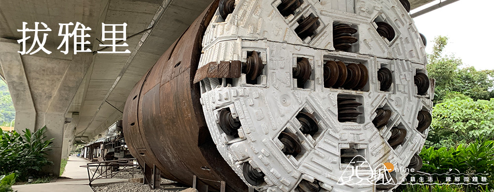
拔雅里因過去芭樂樹遍布而得名,如今仍有居民以務農為生,主要栽種芭樂與蓮霧。
該地區特色鮮明,有許多新興住宅,居住環境優質,此外,也是重要的學區,除有頭城國中外,還有以實驗教育聞名的人文國民中小學。由於位於頭城火車站後方,交通便利。
從頭城火車站旁地下道可抵達此區。→更多拔雅里生活資訊
Bayali Village
Bayali, once known for its abundant guava trees, remains a hub for agriculture. The locals primarily grow guavas and wax apples, keeping the area’s farming heritage alive.
This district is known for its excellent living conditions, with modern residential developments and a strong focus on education. It is home to Tou Cheng Junior High School and the renowned Humanistic Experimental School, famous for its experimental education.
Located just behind Tou Cheng Train Station, Bayali is highly accessible through the underpass next to the station.→more
武營里
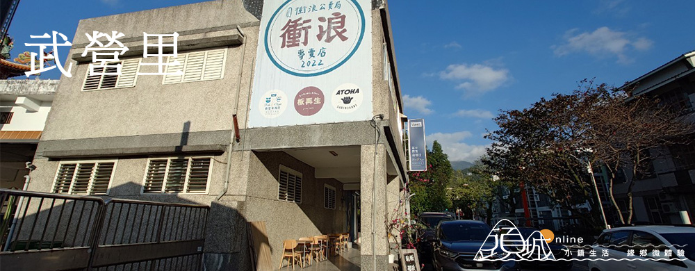
因清代駐軍此區而稱為武營,往北延伸為山區,居民主要務農,生產稻米、蔬菜、水果等,尤其是蓮霧最為著名。
接近頭城市區的部分發展成新興市區,區內有許多公共機關與設施,如活動中心、頭城國小、警察局頭城分駐所、戶政事務所等,從頭城火車站步行可抵達。→更多武營里生活資訊
Wuying Village
Wuying was named after the military camp stationed there during the Qing Dynasty. The northern part extends into mountainous areas, where residents mainly farm, producing rice, vegetables, and fruits, with wax apples being the most famous.
The section closer to Toucheng’s urban area has developed into a vibrant new district. It features various public facilities, including a community center, Tou Cheng Elementary School, a police station, and a household registration office.
Wuying is easily accessible on foot from Tou Cheng Train Station.→more
大坑里
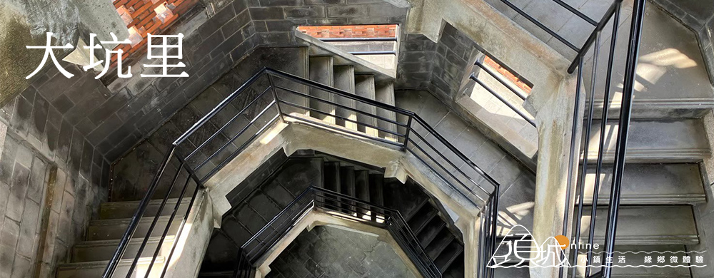
大坑里位於宜蘭河舊河道出口附近,以大坑河為界,與頭城河交會後入海。沿海為沙岸,有規劃完整的頭城海水浴場,旁邊是中華國際電信頭城海纜通訊中心。里內主要的公共設施有基督教女青年會聽濤營電臺、頭城網球場、大坑集會所等,里內的協天宮是在地著名的寺廟。
大眾交通方式:搭乘火車至頭城車站,轉乘台灣好行巴士或步行15分鐘可達。→更多大坑里生活資訊
Dakengli Village
Dakengli is located near the former riverbed outlet of the Yilan River. It is bordered by the Dakeng River, which merges with the Toucheng River before flowing into the sea.
Along the coast, there is a sandy shoreline with the well-developed Toucheng Beach, a popular spot for beachgoers. Nearby is the Chunghwa Telecom Toucheng Submarine Cable Communication Center.
Within Dakengli, you’ll find several main public facilities, including the YWCA Tingtao Camp, Toucheng Tennis Courts, and Dakeng Meeting Hall. A well-known local temple, Xietian Temple, is also located in this area.
Public Transportation: Take the train to Toucheng Station, then transfer to the Taiwan Tourist Shuttle bus, or walk for about 15 minutes to reach Dakengli.→more
新建里
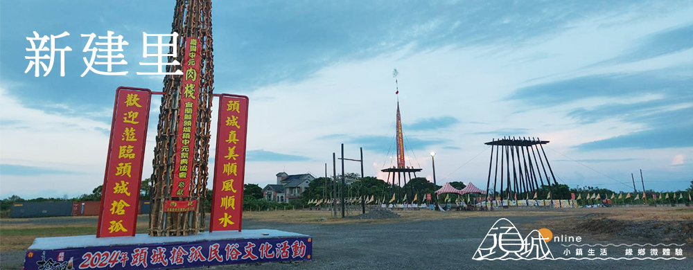
福德坑溪貫穿新建里,溪北岸目前已經成為新興的街區,鎮公所、圖書館、吉祥夜市都位於此區域,往海的方向,有著世界知名的搶孤園區。頭城家商則位於南岸,南岸多是農業區,但現今仍從事農業的人口越來越少,多為老農。
從頭城火車站步行可抵達頭城鎮公所與頭城家商。→更多新建里生活資訊
Xinjian Village
The Fude Keng Creek runs through Xinjian Village, with the northern bank of the creek now developed into a vibrant new district. This area is home to the township office, library, and the popular Jixiang Night Market. Moving toward the sea, you’ll find the world-famous Qiangguo Park.
The Toucheng Commercial and Vocational School is located on the southern bank, which is primarily an agricultural area. However, the number of people still engaged in farming is steadily decreasing, with many residents being elderly farmers.
It’s a short walk from the Toucheng Train Station to the township office and the Toucheng Commercial and Vocational School.→more
金面里
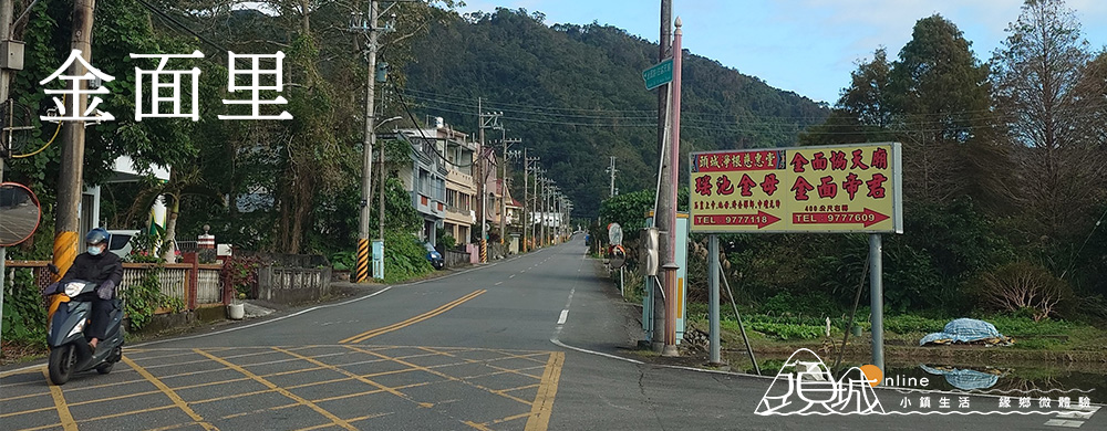
位於北宜公路山腳下,居民分布於宜三路道路兩側、活動中心旁及省道兩旁,居民務農為多,農產以稱米、柑桔為主。因本區有山,形若金字形,故稱金面山。北宜公路上的蘭陽八景之一「金面大觀」,是觀賞宜蘭景觀最佳之處。蘭陽八景之一「金面大觀」位於北宜公路的最高點,海拔高度為583公尺,在此可盡收蘭陽平原及山海美景。→更多金面里生活資訊
Jinmian Village
Located at the foot of the Beiyi Highway, residents of Jinmian Village are mainly distributed along Yisan Road, near the activity center, and along the provincial highway. The majority of residents are engaged in agriculture, with rice and citrus being the main produce.
The area is named after Jinmian Mountain, which has a shape resembling a golden face. One of the “Eight Scenic Spots of Lanyang,” the “Jinmian Grand View,” located on the highest point of Beiyi Highway at an altitude of 583 meters, offers the best vantage point to enjoy the beautiful views of the Lanyang Plain and the surrounding mountains and sea.→more
頂埔里
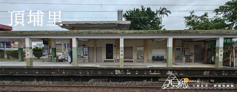
「埔」指未開發的荒埔,頂埔是所在地勢較高處,以往農業與養殖業發達。北管子弟團頂蘭社、集蘭社也在本里,此外,建於1925年的林朝宗住宅,為傳統三合院建築,壁雕精細美觀,為宜蘭縣內保存完整的古厝。→更多頂埔里生活資訊
Dingpu Village
The term “pu” refers to undeveloped land, and Dingpu is located at a higher elevation. In the past, agriculture and aquaculture were well-developed in this area.
Dingpu is also home to the Beiguan Troupe, including the Dinglan and Jilan Societies. Additionally, the Lin Chaozong Residence, built in 1925, is a traditional three-section courtyard house with intricate and beautiful wall carvings. It is one of the well-preserved ancient houses in Yilan County.→more
二城里
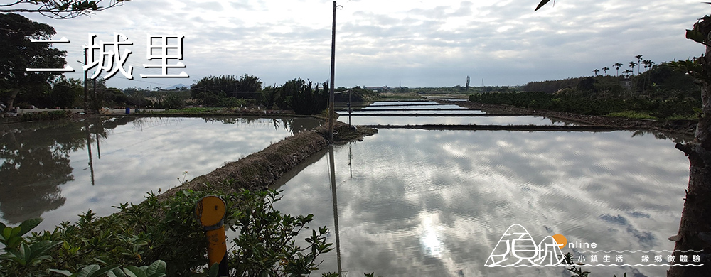
二城里位於頭城最南邊,與礁溪接壤,為開蘭第二城,因此得名,自清代就開始屯墾,里民多務農,以種稻為主,民間信仰濃厚,巷弄間常見宮廟,比較具規模的有威惠廟、瑞陽宮、圓通寺、福德廟。此外,著名的和風飯店位於本里。→更多二城里生活資訊
Ercheng Village
Ercheng Village is located at the southernmost part of Toucheng, bordering Jiaoxi. It is named “Ercheng” as it is the second city established when opening up the Lanyang area. Settlement began during the Qing Dynasty, and most residents are engaged in farming, primarily rice cultivation.
The village has a strong local religious culture, with many temples scattered throughout the alleys. Notable temples include Wei Hui Temple, Ruiyang Palace, Yuantong Temple, and Fude Temple.
Additionally, the famous He Feng Hotel is located in this village.→more
金盈里
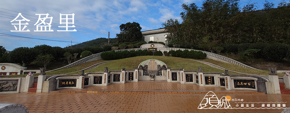
北宜公路自本里中間穿越,里內主要道路為北宜公路和宜三路,金盈瀑布相鄰,風光秀麗,里內有蘭陽首位進士楊士芳祖墓墓園,墓園佔地甚廣,是宏偉的清代墓葬景觀。詳情可見蘭陽博物館的介紹。
Jinyin Village
The Beiyi Highway runs through the middle of Jinyin Village, with its main roads being the Beiyi Highway and Yisan Road. The nearby Jinyin Waterfall offers stunning natural scenery.
The village is also home to the ancestral tomb of Yang Shifang, the first scholar from Lanyang to pass the imperial examination. This expansive site is an impressive Qing Dynasty burial ground.
For more details, visit the Lanyang Museum’s introduction.→more
中崙里
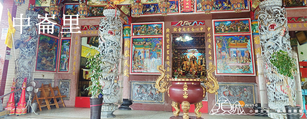
中崙里的特色是境內河川多,因此橋樑也多,著名的就有七座。居民以農業與養殖漁業為主,里內設有社區托兒所、活動中心,並以中興廟為信仰中心,老人活動聚會所也設立在中興廟內。
Zhonglun Village
Zhonglun Village is characterized by its numerous rivers, which have led to the construction of several bridges, including seven notable ones. The local residents primarily engage in agriculture and aquaculture.
The village is equipped with a community daycare center and an activity center, with Zhongxing Temple serving as the main place of worship. The elderly activity center is also located within the temple grounds.→more
下埔里
下埔里以養殖漁業為主,有草蝦、鰻魚、蟳等多樣水產,如今更發展出釣蝦場與釣魚池,成為人們休閒去處。珍貴的濕地環境吸引了眾多候鳥前來棲息,增添自然魅力。近年來,在地志工積極投入清理與維護,使下埔綠色隧道煥然一新,成為廣受歡迎的景點,是旅遊的另類選擇。→更多下埔里生活資訊
Xiabu Village
Xiabu Village is known for its aquaculture industry, producing a variety of seafood such as tiger prawns, eels, and crabs. It has also developed shrimp fishing farms and fishing ponds, offering popular recreational activities.
The area’s valuable wetlands attract many migratory birds, adding to its natural appeal. In recent years, local volunteers have actively worked to clean and maintain the Xiabu Green Tunnel, transforming it into a vibrant and well-loved attraction, making it a unique destination for visitors.→more
竹安里
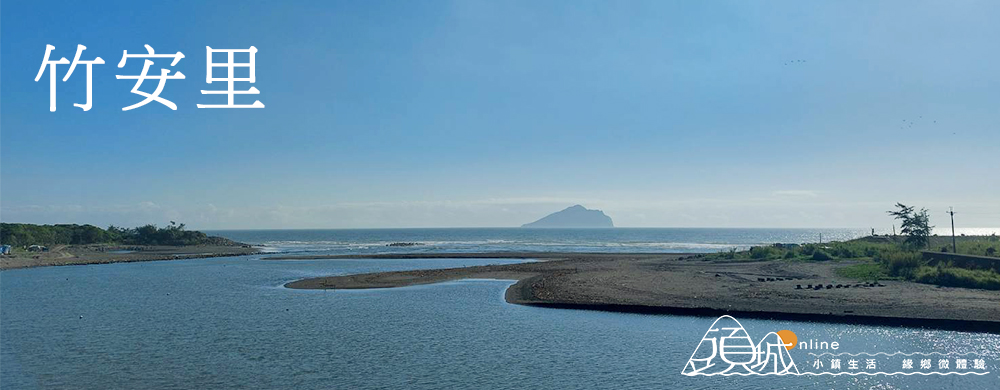
竹安里東臨大海,西被河川環抱,昔日從頭城市區前往竹安,需搭乘渡船方能抵達。直到濱海公路通車並修建橋梁後,對外交通才逐漸便利。如今,竹安溪口成為賞鳥勝地,沿海設有自行車道,騎行其間可一路欣賞壯麗的海岸風光,亦是觀賞龜山島日出的絕佳地點。→更多竹安里生活資訊
Zhuan Village
Zhuan Village is bordered by the ocean to the east and surrounded by rivers to the west. In the past, access from Toucqheng’s urban area required a ferry crossing. Transportation only improved with the construction of the Coastal Highway and bridges.
Today, the estuary of Zhuan River is a popular bird-watching destination. Along the coast, a bike path offers stunning views of the coastline, making it an excellent spot for cycling. It is also one of the best locations to enjoy a sunrise over Turtle Island.→more
